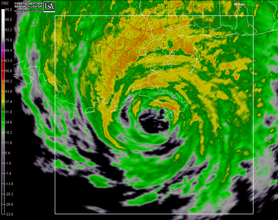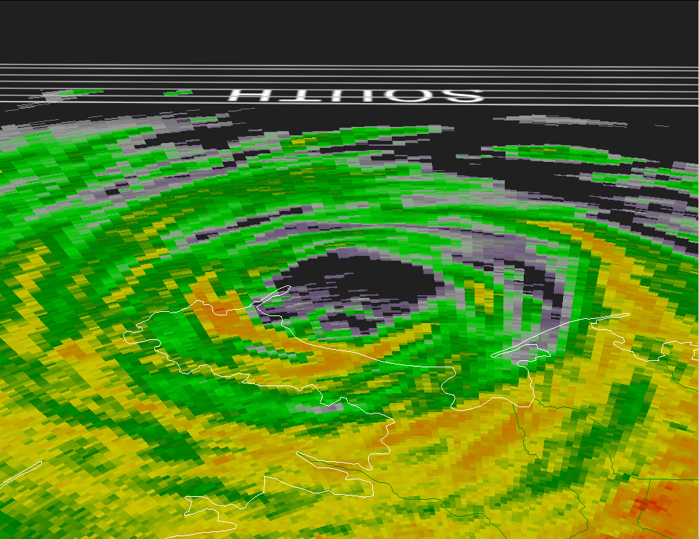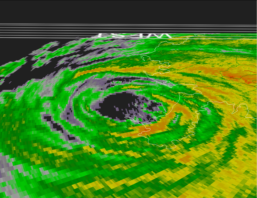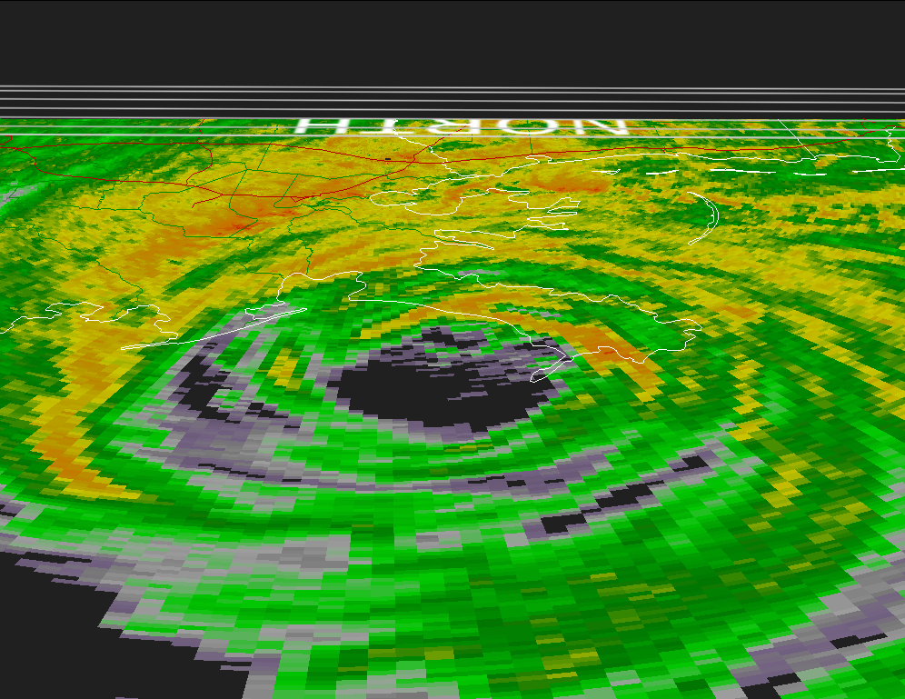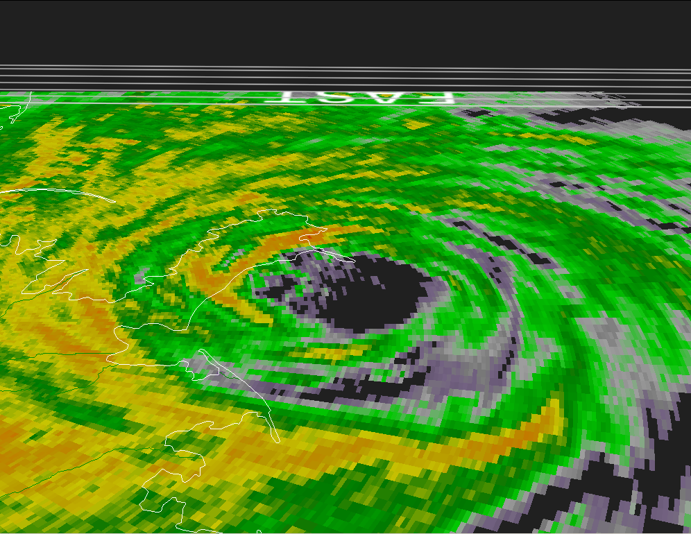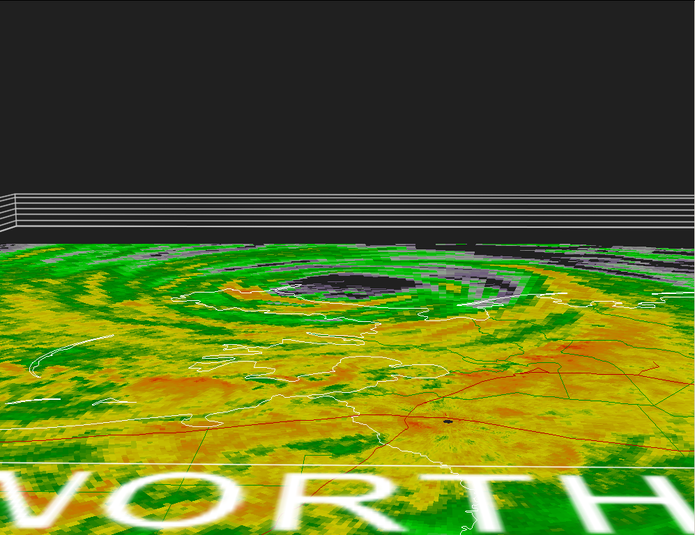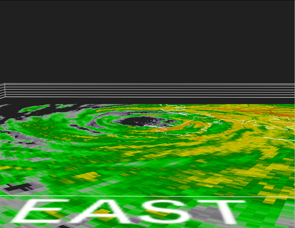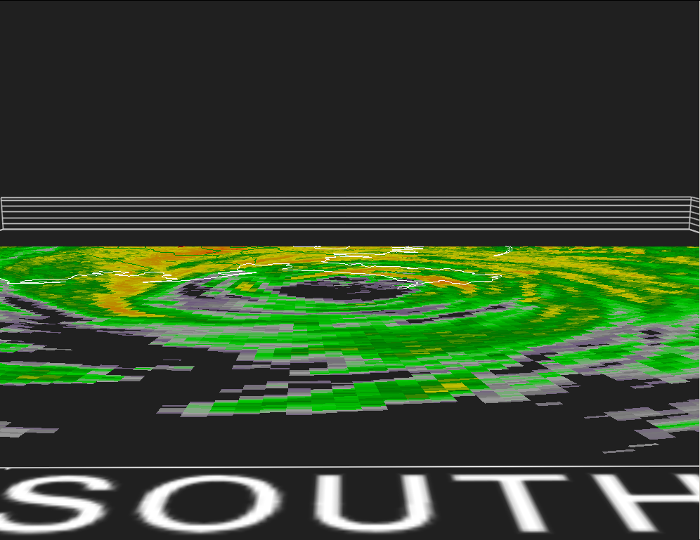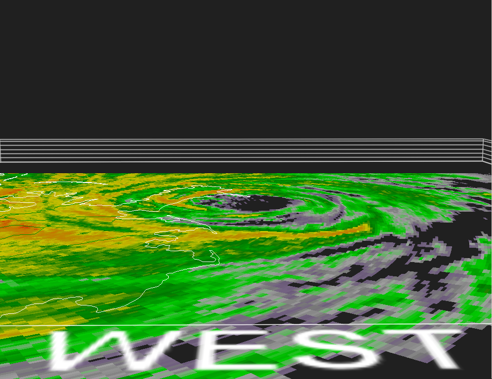
Hurricane Katrina Radar Images
Radar imagery reveals the precipitation pattern and intensity in a hurricane by using colors. In two dimensional imagery at low and high levels, the eye wall can be seen wrapped around the clear eye. However, notice that the rainfall varies around the eye as indicated by the presence of different colors. It is not unusual for variations in intensity to occur as dry air penetrates the eye wall and reduces rainfall in some areas. This intrusion of dry air may result in an "open eye wall". Shortly after these images, Katrina developed an open eye wall to the southwest of the storm center.